
Imagine a road that spans 9.5 miles and fuels the city’s pulse. FDR Drive runs along Manhattan’s east riverfront, linking local drivers, shopkeepers, and neighbors every day.
Built in the 1920s to keep New York moving, this road has carved out a unique slice of history. It is more than just asphalt; it tells a story of design and ambition that still drives the city.
Every morning and evening, thousands rely on FDR Drive for a smooth commute. It remains a vital artery in the daily life of our streets.
FDR Highway Route and Overview in NYC
FDR Drive, or FDR Highway, runs 9.5 miles along Manhattan’s east riverfront. It starts at South and Broad Streets near the Battery and winds up to the Triborough Bridge at East 125th Street. This scenic road has six lanes, each 12 feet wide. In Lower Manhattan, about 175,000 vehicles use it every day, while Midtown sees around 150,000.
The speed limit here is 40 MPH. This helps manage the heavy traffic on an older roadway. Daily commuters, local business owners, and residents depend on FDR Drive for a steady connection along the East River. As you drive, you might notice how the narrow lanes and steady pace shape your travel. It’s a real slice of New York traffic life.
FDR Drive was built to keep traffic moving while still adding a touch of urban beauty. Its layout serves both local drivers and those on longer trips. Every day, this busy highway plays a key role in linking important neighborhoods and keeping the city moving forward.
For anyone using this route, local traffic updates and highway condition reports are essential. Stay informed to beat the usual delays along this busy stretch.
History and Construction of the FDR Highway
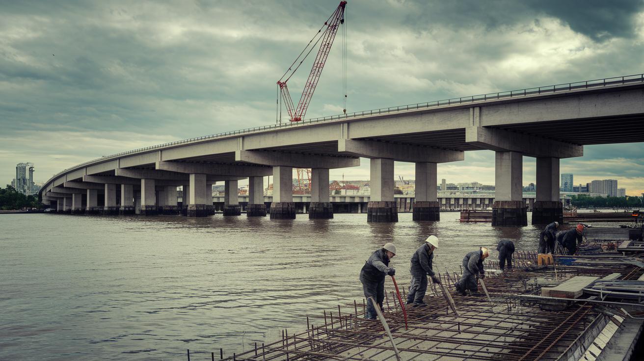
The FDR Highway began in the 1920s when planners pushed for a waterfront road and a idea known as the Chrystie-Forsyth Parkway in the 1929 Regional Plan. Robert Moses dreamed of a six-lane highway along the river, with green spaces in between to brighten the city and improve air quality. In 1934, New York broke ground on a controlled-access highway meant to serve both local residents and long-distance drivers.
By 1936, the WPA cleared buildings between Grand and 14th Streets to make space for the project. Workers extended sewers to the East River, installed catch-basins, and laid a nine-inch concrete base along the route. Fun fact: before construction, crews reused debris from bombed Bristol to fill low spots near Bellevue Hospital, earning the area the nickname "Bristol Basin." This clever reuse of materials lowered costs and kept jobs steady during hard times.
Moses combined smart design with practicality. He planned a roadway that moved traffic efficiently while setting aside green areas along the river. Today, the FDR Highway stands as a reminder of New York City's ongoing effort to balance fast travel with quality public space.
Structural and Engineering Milestones on the FDR Highway
FDR Highway has changed a lot over the years. Major work turned a boulevard into a parkway with controlled access, designed to keep up with more cars and make the ride safer along Manhattan's east riverfront.
- In 1948, crews updated the road between East 49th and 92nd Streets. They gave it a modern, controlled-access design that helped traffic flow smoother in a busy area.
- In 1952, work along East 42nd to East 49th Streets added a special cantilever for the United Nations complex. This upgrade mixed an iconic design with necessary road improvements.
- In 1954, the South Street Viaduct was rebuilt. The project used creative methods to handle heavy city traffic while blending old structures with new fixes.
- In 1960, the viaduct from Jackson Street to East 14th Street was built. This project improved connections and helped ease congestion in lower Manhattan.
- In 1966, enhancements between East 14th and East 42nd Streets boosted the road's capacity and safety. New bridges at key intersections eased traffic further.
Back in 1971, there was a plan for an eight-lane tunnel with 12-foot lanes and a 14.5-foot clearance. It was designed for speeds up to 50 MPH. The tunnel was never built, so later projects kept improving the existing roadway instead.
Traffic Flow and Current Conditions on the FDR Highway
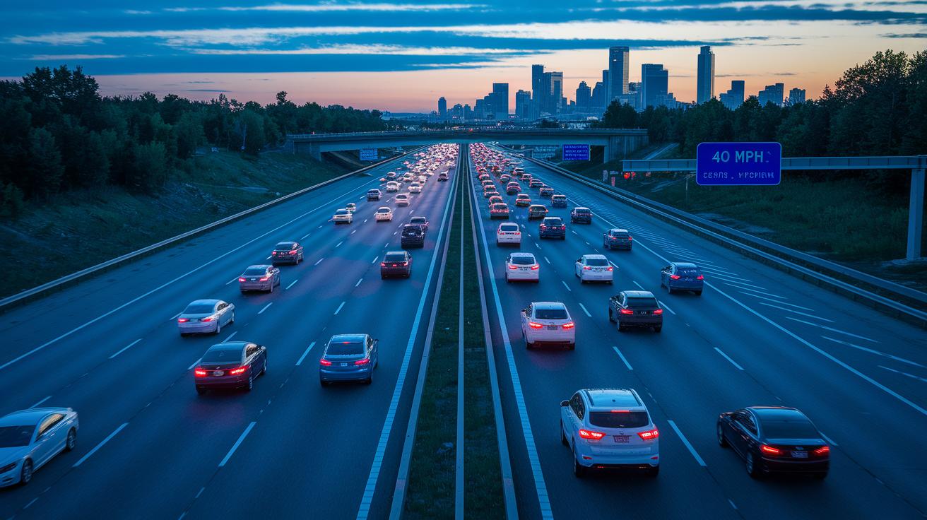
Every day, drivers face tight conditions on the FDR Highway. The narrow shoulders and small lanes force many to slow down, even though the sign still calls for 40 MPH. Did you know that about 175,000 vehicles move through lower Manhattan while Midtown sees around 150,000 cars each day? This heavy traffic puts major strain on a road built long ago with little room for today’s rush.
The highway’s design was once cutting-edge but now shows its age. Slowdowns happen often because too many cars try to use too few lanes. Sometimes, crews close lanes to check wooden supports that are damaged by marine borers. These pests, similar to termites, damage the supports so the crews set aside lanes for repairs and safety checks.
Narrow lanes and frequent closures add to the delays, especially during rush hours. For commuters and local business owners, this is a daily reminder that even a famous road like the FDR Highway can struggle with old infrastructure and heavy use.
Planned Improvement and Redevelopment Projects for the FDR Highway
Between December 2002 and late 2006, a $139 million rehabilitation project refreshed the road from East 54th to East 63rd Streets. Crews also built a temporary 25-foot-wide detour bridge costing $40 million. This bridge helped traffic flow smoothly while the main viaduct got a major update to boost safety.
Next up, the NYSDOT is set to rebuild the viaduct from East 25th to East 42nd Streets. The plan adds a new riverfront esplanade, grade-separated ramps for pedestrians, and a two-way bike lane. These changes will modernize the highway, making it friendlier for both drivers and community users. Officials are also studying a tunnel option along the FDR Drive right-of-way. This tunnel might cut down on surface traffic while still handling many cars.
Plans are in the works for South Street too. One idea is to turn the northbound lanes into a pedestrian esplanade at an estimated cost of $35 million. Another bigger proposal aims to overhaul the South Street viaduct for around $150 million. This plan includes rebuilding piers, better lighting, and soundproofing to make commuting less noisy and safer.
These projects show the city's commitment to modernizing the FDR Highway. The updates will boost safety, add more travel options, and keep this historic road a vital part of New York City's transport system.
Navigational Tools and Maps for the FDR Highway in NYC
When you drive on the FDR Highway, having current maps and live data makes all the difference. Official sources like the National Map Viewer show you both today's conditions and how the highway was set up long ago. A local guide might tell you, "Historical maps reveal that parts of the highway were planned decades ago but still serve today's commuters."
NYSDOT offers live traffic cameras at key crossings. These feeds let you see real traffic conditions so you can quickly decide if an alternate route is needed during rush hours or when construction is on the road.
Mobile apps such as Google Maps deliver real-time congestion updates and exit alerts directly on your device. Many even let you download a printed PDF map for offline reference.
For anyone who uses the highway often, these tools make travel planning easier. By combining historical maps, live camera updates, and modern navigation apps, drivers can get the timely information they need to avoid delays and stay on track.
Exits, Access Points, and Safety Features of the FDR Highway
Exit 6 has been closed since Sept. 11, 2001, with its signs taken down in 2016. This spot, right by a Con Edison substation, is a key landmark for drivers navigating the highway. A steady red light at a dead-end ramp warns drivers to avoid going the wrong way. Instead of typical shoulders, the highway has emergency pull-off ramps placed at regular intervals to give drivers a safe spot in case of trouble.
At 93rd Street, there’s a tiny pocket park covering just 0.03 acres. It features a stone that reads "East River Drive Triborough Bridge Approach." This marker serves as a small piece of local history and a brief break for pedestrians. Together, these details show how the FDR Highway blends safety measures with practical access points to manage heavy traffic and care for walkers.
| Feature | Location | Detail |
|---|---|---|
| Exit 6 Closure | Near Con Edison substation | Closed since Sept. 11, 2001; signs removed in 2016 |
| Red Light Warning | Dead-end ramp | Warns drivers against wrong-way entries |
| Emergency Pull-off Ramps | Along the highway | Installed at regular intervals in place of shoulders |
| 93rd Street Pocket Park | 93rd Street | 0.03-acre park with a stone marker saying “East River Drive Triborough Bridge Approach” |
Cultural Landmarks and Public Art along the FDR Highway
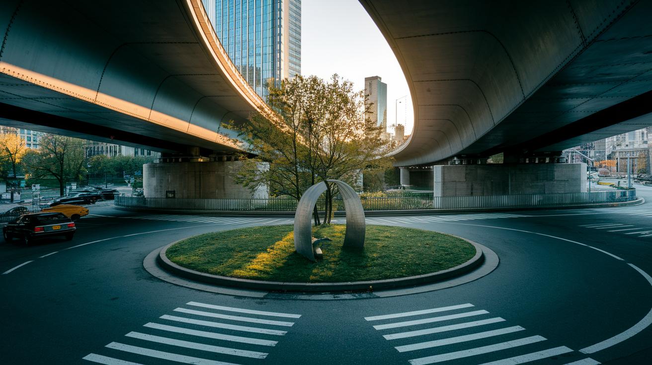
Right under the Ed Koch Queensboro Bridge, you'll find Alice Aycock’s East River Roundabout. Made in 1994 and refreshed in 2017, this art piece cuts through the routine of traffic and gives drivers a moment to appreciate New York City's rich past. Its curvy, lively design quietly tells the story of our city.
Between East 53rd and East 60th Streets, Stacy Levy’s Diatom Pavers bring a cool twist to the public walkway. Created in 1994 with embossed diatom patterns, these pavers add texture and spark conversation among pedestrians. Fun fact: they began as simple design experiments before locals embraced them as a landmark.
SHoP Architects also left their mark by using a color called Almost Purple on parts of the highway. This bright hue not only makes the road more visible but also gives drivers a sense of safety. Small parks and other art pieces combine here to give the FDR Highway a unique, living vibe for our community.
Final Words
In the action, this post tracked the FDR Highway route and its key details. We covered its full stretch, lane setup, speed limits, and daily traffic flows. It walked through the highway's history, major bridge and viaduct projects, and current issues that slow traffic. We also highlighted upcoming fixes and tools to help you plan your route along fdr highway nyc. The post rounded out with safety spots, exits, and local art that marks its unique identity.
All in all, change is on the horizon.
FAQ
How can I view a map of the FDR Highway NYC?
The FDR Highway NYC map shows the road’s path along Manhattan’s east riverfront from South and Broad Streets to the Triborough Bridge, helping you locate key exits and plan your route.
How do I get directions for FDR Drive in NYC?
FDR Drive directions are available on Google Maps and similar apps, offering real-time traffic updates and clear, step-by-step instructions for a smooth trip.
What should I do when FDR Drive is closed today?
FDR Drive closure info is reported by local news and NYSDOT live feeds, which give you alternate routes and updated travel times to help manage your commute.
How can I access maps for FDR Drive northbound entrances?
Maps for FDR Drive northbound entrances are found on the National Map Viewer and local transportation apps, highlighting key access points and current traffic conditions for easier navigation.
Why is it called FDR Drive?
FDR Drive is named to honor Franklin Delano Roosevelt for his lasting impact on New York and his service to the nation, reflecting the region’s historical legacy.
Where does FDR Drive start and end?
FDR Drive begins at South and Broad Streets at the Battery and continues along Manhattan’s east riverfront, ending at the Triborough Bridge at East 125th Street, spanning about 9.5 miles.
Is Harlem River Drive the same as FDR Drive?
Harlem River Drive is different from FDR Drive. While FDR Drive runs along the east riverfront, Harlem River Drive follows a separate route along the Harlem River in Manhattan.
Does the historic Five Points still exist in New York?
The historic Five Points neighborhood no longer exists as it did in the past. Urban changes over many years have reshaped the area, preserving only fragments of its old character.